


Geoarcheology Research Associates (GRA) was subcontracted by Hunter Research Inc. (HRI) under contract to Barry Vittor & Associates to develop a geomorphological and archaeological model of the submerged paleoenvironment for the U.S. Army Corps of Engineers (USACE), New York District in connection with the New York and New Jersey Harbor Navigation Project, Port of New York and New Jersey.
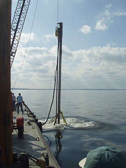
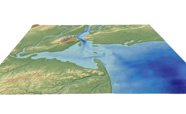
Because of the broad reach of the impact area, the USACE formulated a regionally based strategy for fulfilling its compliance responsibilities based on the hypothesis that Holocene sea level rise systematically drowned landscapes that would have sustained archaeological sites when coastlines extended to the edge of the Continental Shelf. A key objective of the study was to track the landward migration of the shoreline over the past 12,000 years. Pilot field studies involved deep testing efforts to develop a baseline for the submerged stratigraphy and cultural resource potential for New York Harbor and to mitigate impacts to specific segments scheduled for channel widening.
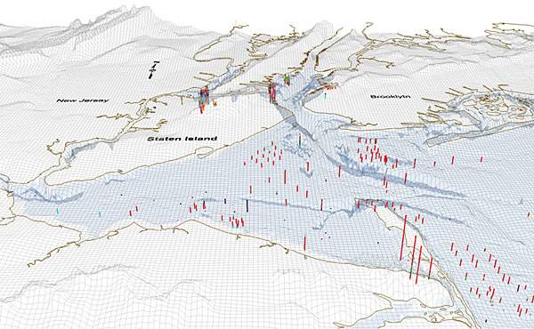
The goal of most recent study was twofold. First, it assembled previous data from earlier studies by GRA and others to expand upon the baseline stratigraphic and archaeological sensitivity models presented in previous reports. A critical assessment of the boring logs and data identified the most critical gaps in the current subsurface data record as based on the preliminary model of landscape change and archaeological resource potential. Additional subsurface data needed to develop a comprehensive human and natural landscape model were acquired. The second goal was a systematic integration of spatial landscape data to enable planners and scientists to make key decisions on cultural resource sensitivity issues. To date, various data sets have been assembled by diverse research groups that include soil scientists, Quaternary geologists, archaeologists, and marine biologists among others. Compilation of these data sets is most effectively attained by the application of Geographic Information Systems (GIS) mapping technology.
GIS based data sets focused on illustrating paleoenvironmental reconstructions that allow a scientifically-based assessment of archaeologically sensitive areas (with respect to deglaciation, sea level rise, paleogeography, and the effects of marine erosion). The study provided digitized data sets for planners to view the entire project area as an impact zone and to further assist in prioritizing and developing compliance sensitive mitigation strategies for future harbor engineering and dredging projects.