


Geoarcheology Research Associates (GRA) was contracted by the Somerset-Raritan Valley Sewerage Authority (SRVSA) to undertake geoarcheological investigations at the site of the proposed New Relief Interceptor in Somerset County, New Jersey.
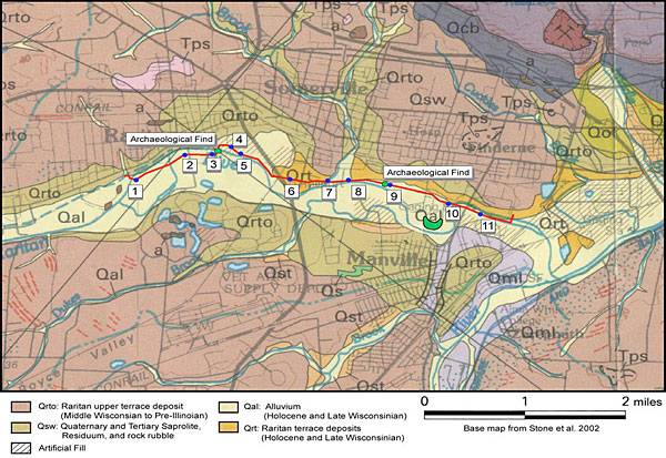
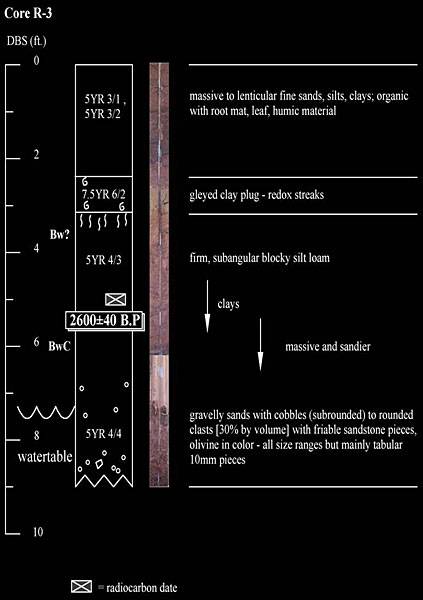
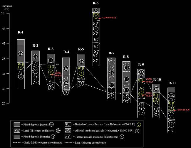
The objectives were to assess the possibilities of encountering buried cultural resources within deposits of probable Holocene age along the project impact area, which extended for approximately 22,500 feet (6820 m) parallel to the floodplain margins of the lower Raritan River. An initial Phase I survey identified the presence of prehistoric scatters ranging from the Late Archaic through Woodland periods (ca. 5000 B.P.- 500 B.P.) in test augurs that extended to depths of 3 feet (<1 m) (Mounier, 2004). The contexts of these deposits were pivotal in determining whether or not more extensive surfaces were buried within the Lower Raritan alluvium and/or related landforms flanking the present channel.
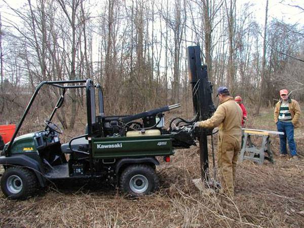
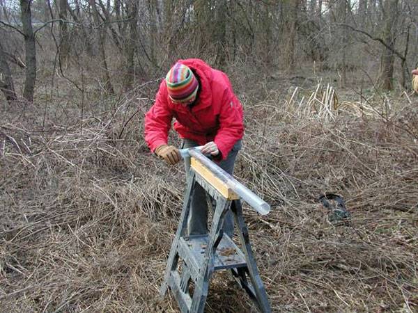
A more general concern was the development of an efficient methodology that would assess buried site potential in landscapes that have been intensively modified by industrial age disturbance. Simple shoveltesting was deemed inappropriate by regulators because of obvious disturbance to upper deposits. By superposing the footprint of the pipeline on the surface geology map, it was possible to identify areas of buried prehistoric potential based on mapped distributions and ages of Late Quaternary deposits and landforms. The next step was systematic placement of geoprobe cores that ground-truthed the mapping units and isolated pristine alluvial deposits that were sampled for dating purposes. It was possible to eliminate disturbed tracts from testing, to date buried deposits that conformed to the age of known Woodland occupations in the area, and to isolate the only intact buried segment of the landscape that could potentially preserve archaeological materials. All this was done without extensive subsurface disturbance. As a result, the sewer authority was able to determine if it wished to test for additional prehistoric site potential or to reroute a small segment of the line. They opted for the former, with the regulator’s approval. The geoarcheological survey and testing effort produced the baseline for a Phase III excavation that was both scientifically sound and cost-effective.